Welcome to BigEyeInTheSky.com
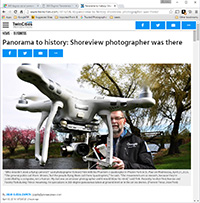
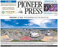
I'm Ed Fink, these are my 360 degree panoramas. I was the first photographer in the world to shoot 360 degree panoramas from a helicopter. Today I'm a FAA licensed drone pilot and shoot most of my aerials with a quadcopter.
In addition to shooting aerial panoramas, I'm also a Google Street View Trusted Photographer in Minneapolis shooting Street View tours inside local businesses.
I publish thousands of 360 degree panoramas and virtual tours to Google Maps, where I currently have over 100 MILLION VIEWS.
Ask me for more information or an estimate for your business!
Facebook - BigEyeInTheSky360
Google Maps - Ed Fink

VISITOR COMMENTS:
"That's the coolest thing on the web."
"You brought tears to my eyes."
"Mind blowing."
"One of the neatest photo sites I've ever seen."
"I'm afraid of heights and when I looked straight down I nearly threw up!"
"I am stunned by the quality and possible applications, nice job."
"That combo of eye-in-the-sky with eyes on the ground is fantastic."
"I sent this to every pilot I know."
"HOW IS THIS EVEN POSSIBLE?!"
"The 360 shots are almost unbelieveable!!!!"
"Oh my gosh Ed - they are just beautiful."
"That aerial panorama over Lake Calhoun is totally awesome"
"FANTASTIC!!!!"
"I've instantly become a fan of your panorama photos!"
"Wow, your panoramas are like nothing I have ever seen before. Very impressive!"
"the absolute best I have seen anywhere."
"ED - I am not surprised by all the comments you have received. The VR is AWESOME!"


Select a panorama category:
This also includes neigboring areas like Disney, NASA Kennedy Space Center, Daytona Beach, and Port Canaveral.
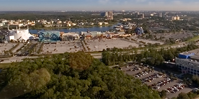
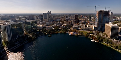 360 degree aerial panorama over Lake Eola in downtown Orlando Florida.
Equipment: Nikon D70s, Sigma 8mm
Helicopter: WFTV Skywitness News
Pilot: Gregg Beck
Categories: Orlando
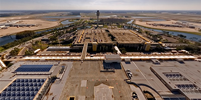 360 degree aerial panorama over the terminal at the Orlando International Airport, in Orlando Florida.
Equipment: Nikon D70s, Sigma 8mm
Helicopter: WFTV Skywitness News
Pilot: Gregg Beck
Categories: Orlando
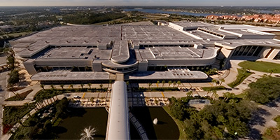 360 degree aerial panorama of the Orange County Convention Center in Orlando, Florida. The two buildings combined have over 2 million square feet of exhibition space, making it the third largest convention center in the U.S.
Equipment: Nikon D70s, Sigma 8mm
Helicopter: Air Florida Helicopters
Pilot: Air Florida Helicopters
Categories: Orlando
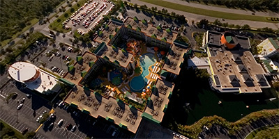
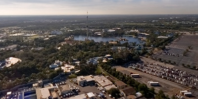 360 degree aerial panorama near SeaWorld in Orlando, Florida. Other visible landmarks include the International Plaza Resort and Spa, and three blocks to the north you can see the Orange County Convention Center.
Equipment: Nikon D70s, Sigma 8mm
Helicopter: Air Florida Helicopters
Pilot: Air Florida Helicopters
Categories: Orlando
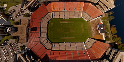 360 degree aerial panorama directly over the Citrus Bowl in Orlando, FL.
Equipment: Nikon D70s, Sigma 8mm
Helicopter: WFTV Skywitness News
Pilot: Gregg Beck
Categories: Orlando
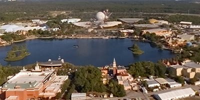 360 degree aerial panorama near Disney ’s Epcot Center Theme Park outside Orlando, Florida.
Equipment: Nikon D70s, Sigma 8mm
Helicopter: Air Florida Helicopters
Pilot: Air Florida Helicopters
Categories: Orlando
 360 degree aerial panorama shot directly over Nickelodeon Family Suites outside Orlando, Florida. Across the highway is the Orlando World Center Marriott and Hawk’s Landing Golf Course, and across from that is Cirque du Soleil - Downtown Disney.
Equipment: Nikon D70s, Sigma 8mm
Helicopter: Air Florida Helicopters
Pilot: Air Florida Helicopters
Categories: Nickelodeon Family Suites, Orlando
 360 degree panorama near Cirque du Soleil - Downtown Disney, outside Orlando, Florida.
Equipment: Nikon D70s, Sigma 8mm
Helicopter: Air Florida Helicopters
Pilot: Air Florida Helicopters
Categories: Orlando
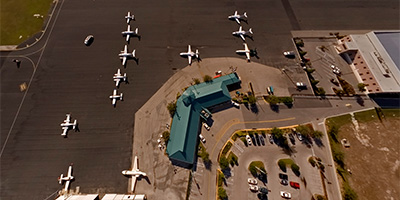 360 degree aerial panorama over the Orlando Executive Airport near downtown Orlando, Florida.
Equipment: Nikon D70s, Sigma 8mm
Helicopter: WFTV Skywitness News
Pilot: Gregg Beck
Categories: Orlando
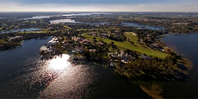 360 degree aerial panorama over Lake Butler in Orlando, Florida, near Isleworth Golf and Country Club.
(I think Tiger Woods’ house is the closest or the second closest house in this aerial.)
Equipment: Nikon D70s, Sigma 8mm
Helicopter: Air Florida Helicopters
Pilot: Air Florida Helicopters
Categories: Orlando
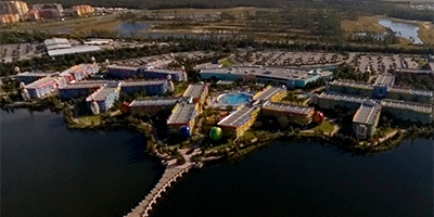 360 degree aerial panorama near Disney’s Pop Century Resort outside Orlando, Florida.
Equipment: Nikon D70s, Sigma 8mm
Helicopter: Air Florida Helicopters
Pilot: Air Florida Helicopters
Categories: Orlando
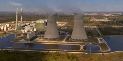 360 degree aerial panorama next to a power plant outside Orlando, Florida.
Equipment: Nikon D70s, Sigma 8mm
Helicopter: WFTV Skywitness News
Pilot: Gregg Beck
Categories: Industrial, Orlando
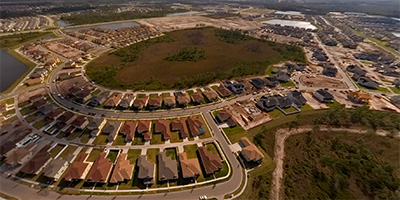 360 degree aerial panorama over the Avalon Park subdivision east of Orlando, Florida.
Equipment: Nikon D70s, Sigma 8mm
Helicopter: WFTV Skywitness News
Pilot: Gregg Beck
Categories: Orlando
 360 degree aerial panorama over Cape Canaveral, Florida.
Equipment: Nikon D70s, Sigma 8mm
Helicopter: WFTV Skywitness News
Pilot: Gregg Beck
Categories: Orlando
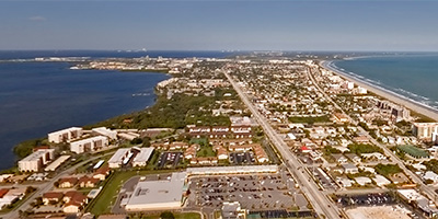
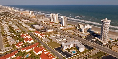 360 degree aerial panorama over Daytona Beach Shores , Florida.
Equipment: Nikon D70s, Sigma 8mm
Helicopter: WFTV Skywitness News
Pilot: Gregg Beck
Categories: Orlando
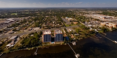
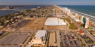 360 degree aerial panorama over Main St. in Daytona Beach, FL.
Equipment: Nikon D70s, Sigma 8mm
Helicopter: WFTV Skywitness News
Pilot: Gregg Beck
Categories: Orlando
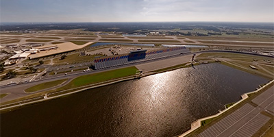 360 degree aerial panorama over the Daytona International Speedway in Daytona Beach, FL, home of the Daytona 500, the Pepsi 400, and the Craftsman Truck Series,
Equipment: Nikon D70s, Sigma 8mm
Helicopter: WFTV Skywitness News
Pilot: Gregg Beck
Categories: Orlando
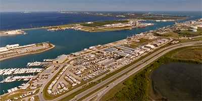 360 degree aerial panorama of Port Canaveral, Florida.
Equipment: Nikon D70s, Sigma 8mm
Helicopter: WFTV Skywitness News
Pilot: Gregg Beck
Categories: Orlando
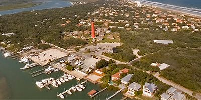 360 degree aerial panorama near the Ponce de Leon Inlet Light Station. The lighthouse, located south of Daytona Beach, is the tallest in Florida and one of the tallest in the country.
Equipment: Nikon D70s, Sigma 8mm
Helicopter: WFTV Skywitness News
Pilot: Gregg Beck
Categories: Orlando
 360 degree aerial panorama of Titusville, FL, across the Indian River from Kennedy Space Center on Merritt Island.
Equipment: Nikon D70s, Sigma 8mm
Helicopter: WFTV Skywitness News
Pilot: Gregg Beck
Categories: Orlando
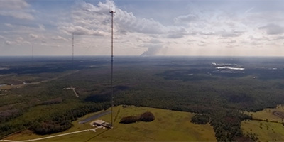 360 degree aerial panorama at the WFTV transmission towers near Orlando, Florida.
Equipment: Nikon D70s, Sigma 8mm
Helicopter: WFTV Skywitness News
Pilot: Gregg Beck
Categories: Orlando
Start with the "Featured" category to see an assortment of my most interesting panoramas.