Welcome to BigEyeInTheSky.com
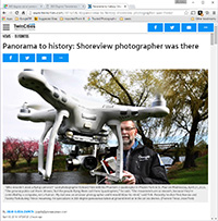
I'm Ed Fink, these are my 360 degree panoramas. I was the first photographer in the world to shoot 360 degree panoramas from a helicopter. Today I'm a FAA licensed drone pilot and shoot most of my aerials with a quadcopter.
In addition to shooting aerial panoramas, I'm also a Google Street View Trusted Photographer in Minneapolis shooting Street View tours inside local businesses.
I publish thousands of 360 degree panoramas and virtual tours to Google Maps, where I currently have over 100 MILLION VIEWS.
Ask me for more information or an estimate for your business!
Facebook - BigEyeInTheSky360
Google Maps - Ed Fink


VISITOR COMMENTS:
"That's the coolest thing on the web."
"You brought tears to my eyes."
"Mind blowing."
"One of the neatest photo sites I've ever seen."
"I'm afraid of heights and when I looked straight down I nearly threw up!"
"I am stunned by the quality and possible applications, nice job."
"That combo of eye-in-the-sky with eyes on the ground is fantastic."
"I sent this to every pilot I know."
"HOW IS THIS EVEN POSSIBLE?!"
"The 360 shots are almost unbelieveable!!!!"
"Oh my gosh Ed - they are just beautiful."
"That aerial panorama over Lake Calhoun is totally awesome"
"FANTASTIC!!!!"
"I've instantly become a fan of your panorama photos!"
"Wow, your panoramas are like nothing I have ever seen before. Very impressive!"
"the absolute best I have seen anywhere."
"ED - I am not surprised by all the comments you have received. The VR is AWESOME!"


Select a panorama category:
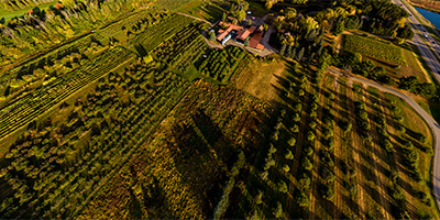 360 degree aerial panorama at Aamodt's Apple Farm west of Stillwater, MN.
Equipment: DJI P4P, 24 mm
Categories: Apple Orchards, Quadcopter, Stillwater
 Fairy Falls sunrise 360 degree aerial panorama north of Stillwater, MN.
Equipment: DJI P4P, 24 mm
Categories: Quadcopter, St Croix River, Stillwater, World Wide Panorama
 Aerial panorama of Girl Scout Camp Sagata.
Equipment: DJI P3A, 20 mm
Categories: Quadcopter, St Croix River, Stillwater
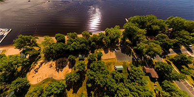
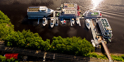 Aerial panorama above Stillwater’s St Croix Boat and Packet Company
Equipment: DJI P3A, 20 mm
Categories: Quadcopter, St Croix River, Stillwater
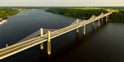 St. Croix Crossing aerial panorama from 380’.
Equipment: DJI P3A, 20 mm
Categories: Bridges, Quadcopter, St Croix River, Stillwater
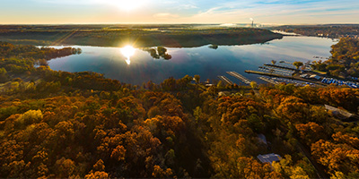
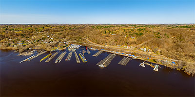 360 degree aerial panorama of St. Croix River flooding north of Stillwater, MN.
Equipment: DJI Air2s, 22 mm
Categories: Quadcopter, St Croix River, Stillwater
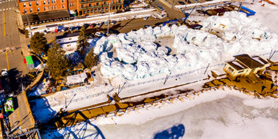 Stillwater Ice Castles 360 degree aerial panorama, from above the old lift bridge.
Equipment: DJI P4P, 24 mm
Categories: Quadcopter, St Croix River, Stillwater, World Wide Panorama

Start with the "Featured" category to see an assortment of my most interesting panoramas.