Welcome to BigEyeInTheSky.com
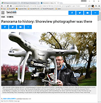
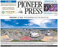
I'm Ed Fink, these are my 360 degree panoramas. I was the first photographer in the world to shoot 360 degree panoramas from a helicopter. Today I'm a FAA licensed drone pilot and shoot most of my aerials with a quadcopter.
In addition to shooting aerial panoramas, I'm also a Google Street View Trusted Photographer in Minneapolis shooting Street View tours inside local businesses.
I publish thousands of 360 degree panoramas and virtual tours to Google Maps, where I currently have over 100 MILLION VIEWS.
Ask me for more information or an estimate for your business!
Facebook - BigEyeInTheSky360
Google Maps - Ed Fink

VISITOR COMMENTS:
"That's the coolest thing on the web."
"You brought tears to my eyes."
"Mind blowing."
"One of the neatest photo sites I've ever seen."
"I'm afraid of heights and when I looked straight down I nearly threw up!"
"I am stunned by the quality and possible applications, nice job."
"That combo of eye-in-the-sky with eyes on the ground is fantastic."
"I sent this to every pilot I know."
"HOW IS THIS EVEN POSSIBLE?!"
"The 360 shots are almost unbelieveable!!!!"
"Oh my gosh Ed - they are just beautiful."
"That aerial panorama over Lake Calhoun is totally awesome"
"FANTASTIC!!!!"
"I've instantly become a fan of your panorama photos!"
"Wow, your panoramas are like nothing I have ever seen before. Very impressive!"
"the absolute best I have seen anywhere."
"ED - I am not surprised by all the comments you have received. The VR is AWESOME!"


Select a panorama category:
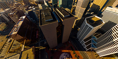
 Foshay Tower from 10th St. 360 degree aerial panorama above downtown Minnepolis, MN.
Equipment: DJI P3A, 20 mm
Categories: Minneapolis, Quadcopter
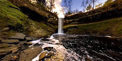 360 degree panorama at the bottom of Minnehaha Falls, with the water flowing strong after a rain.
Equipment: NikonD70, Sigma 8mm, Kaidan QuickPan III
Categories: Minneapolis, Minnehaha Falls
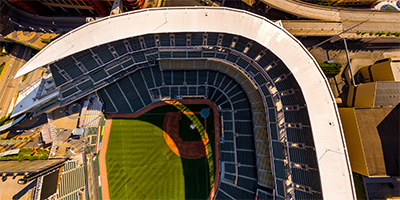 Over Target Field in downtown Minneapolis, MN, home of the Minnesota Twins baseball team.
Equipment: DJI P3A, 20 mm
Categories: Minneapolis, Quadcopter
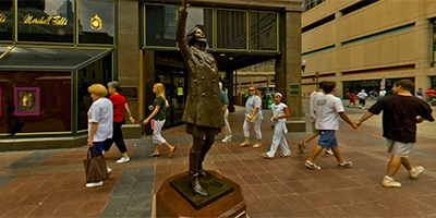 360 degree panorama in front of the Mary Tyler Moore statue on Nicollet Mall at Nicollet and 7th St. in downtown Minneapolis. This is believed to be at the approximate location she tossed her hat in the opening credits to the Mary Tyler Moore show, which took place in Minneapolis.
Good view of the Wells Fargo and IDS buildings.
Equipment: Nikon D70, Sigma 8mm
Categories: Minneapolis
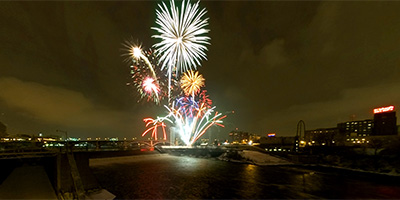 360 degree panorama of the 2005 New Year’s Eve fireworks over the Mississippi River in Minneapolis. Shot from the Stone Arch Bridge, visible landmarks include downtown Minneapolis, St. Anthony Falls, and the northernmost lock and dam on the Mississippi.
Equipment: NikonD70, Sigma 8mm, Kaidan QuickPan III
Categories: Minneapolis
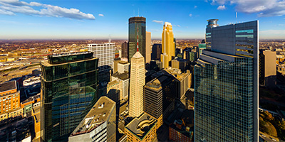
 This is a 360 degree aerial panorama shot from a helicopter over downtown Minneapolis. Landmarks include Target Center and the Metrodome, and the Mississippi River, including the site of the first bridge over the river, St. Anthony Falls, and the Stone Arch Bridge.
Equipment: NikonD70, Sigma 8mm
Helicopter: Hummingbird Helicopters
Pilot: John Lindstrom
Categories: Minneapolis, Mississippi River
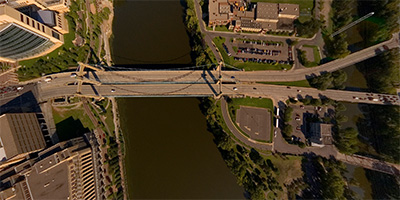
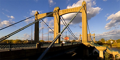 360 degree panorama at the Hennepin Ave. Bridge, which is at the site of the first permanent bridge across the Mississippi River, anywhere along it’s length. The large building at the base of the bridge on the right is the Minneapolis Post Office, and is on the site of the first permanent white dwelling on this side of the river.
Equipment: Nikon D70, Sigma 8mm
Categories: Bridges, Minneapolis, Mississippi River
 360 degree panorama of the St. Anthony Falls, Mississippi River lock and dam, and downtown Minneapolis from the Stone Arch Bridge at sunrise.
Equipment: Nikon D70, Sigma 8mm
Categories: Bridges, Minneapolis, Mississippi River
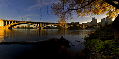 360 degree panorama of the Central Ave. bridge and downtown Minneapolis from Nicollet Island at sunset.
Equipment: Nikon D70, Sigma 8mm
Categories: Bridges, Minneapolis, Mississippi River
 360 degree panorama in the middle of a huge crowd of zombies being entertained by an Aztec warrior in the downtown Minneapolis Quarantine Zone during the 2013 9th annual Zombie Pub Crawl.
Equipment: Nikon D700, Nikkor 10.5mm (shaved), Nodal Ninja Ultimate R1
Categories: Minneapolis, Zombies
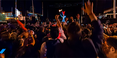
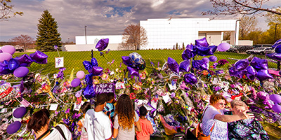
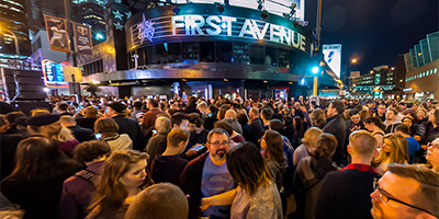 Prince tribute at First Ave. on 4/21/2016, the day he died. Thousands of people turned out in downtown Minneapolis to mourn him.
Equipment: Nikon D700, Nikkor 10.5mm (shaved), Nodal Ninja Ultimate R1
Categories: First Avenue, Minneapolis, Music, Prince Memorials
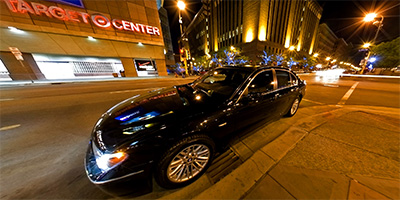 360 degree panorama of Cities Limousine and Transportation’s 2005 BMW 745Li Luxury Sedan parked on First Avenue in front of Bellanotte, across from Target Center in downtown Minneapolis.
Equipment: NikonD70, Sigma 8mm, Kaidan QuickPan III
Categories: Minneapolis, Vehicles
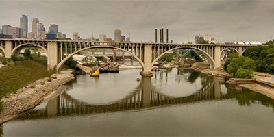
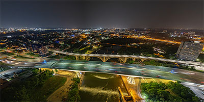 360 degree aerial panorama over Lock and Dam #1 near the I-35W Mississippi River Bridge in Minneapolis, MN, a few days after the 16th anniversary of the bridge collapse.
Equipment: DJI Air2s, 22 mm
Categories: 35W Bridge Collapse, Bridges, Featured, Minneapolis, Mississippi River, Quadcopter
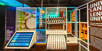 360 degree panorama at an interactive exhibit at the Bakken Museum in Minneapolis, MN.
Equipment: Ricoh Theta Z1, FE
Categories: Minneapolis
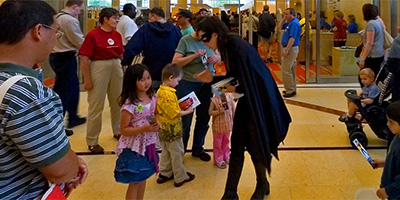 360 degree panorama of Batgirl handing out bookmarks to kids inside the new Minneapolis Library during the grand opening.
Equipment: Nikon D70s, Sigma 8mm, Kaidan QuickPan III
Categories: Minneapolis Library, Minneapolis
 360 degree panorama on 10th St. at Harmon Place, between First Baptist Church and University of St. Thomas. In downtown Minneapolis, Minnesota.
Equipment: NikonD70s, Sigma 8mm, Nodal Ninja 3, PocketWizard Plus
Categories: Minneapolis
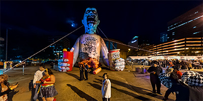 360 degree panorama in front of Phil, the 50’ inflatable zombie in the downtown Minneapolis Quarantine Zone of the 2013 9th annual Zombie Pub Crawl. We’re used to seeing victims like Zombie Wonder Woman, Zombie Waldo, a mob of Zombie Clowns, Zombie Jester, Zombie Cow, Zombie Penguin, and others. But it’s especially sad when the victim of the zombie apocalypse is an innocent 9 year old lab assistant.
Equipment: Nikon D700, Nikkor 10.5mm (shaved), Nodal Ninja Ultimate R1
Categories: Minneapolis, Zombies
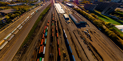
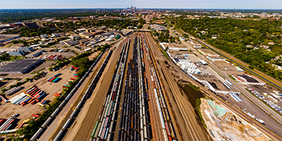 360 degree aerial panorama over the BNSF Midway Railroad Yard in South St. Anthony between Minneapolis and St. Paul.
Equipment: DJI P4P, 24 mm
Categories: Industrial, Minneapolis, Quadcopter, Railroads
 360 degree aerial panorama directly over the BNSF Northtown Railroad Yard in Columbia Heights, just north of Minneapolis.
Equipment: DJI P4P, 24 mm
Categories: Industrial, Minneapolis, Quadcopter, Railroads
 360 degree aerial panorama over the BNSF Bridal Veil Railroad Yard Minneapolis, MN.
Equipment: DJI P4P, 24 mm
Categories: Industrial, Minneapolis, Quadcopter, Railroads
 360 degree aerial panorama across from the giant Bob Dylan The Times They Are A Changin' mural in downtown Minneapolis on the first business day of the statewide COVID 19 lockdown. Definitely doesn't look like a normal rush hour! This was my Spring Equinox 2020 submission to the World Wide Panorama on the theme Change.
Equipment: DJI P4P, 24 mm
Categories: Featured, Minneapolis, Music, World Wide Panorama
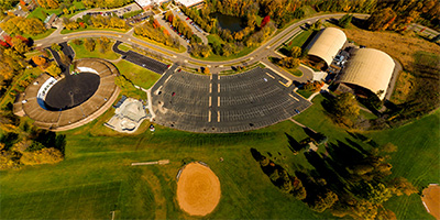 Aerial panorama of Burnsville Ice Center and The Garage.
Equipment: DJI P3A, 20 mm
Categories: Minneapolis, Quadcopter
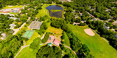
 360 degree aerial panorama over Bush Lake in Bloomington, MN.
Equipment: DJI P4P, 24 mm
Categories: Minneapolis, Quadcopter
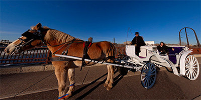 360 degree panorama of The Hitching Company’s horse and carriage on the Stone Arch Bridge. The Hitching Company offers carriage ride tours along the Mississippi River and Nicollet Mall in downtown Minneapolis.
Equipment: NikonD70, Sigma 8mm, Kaidan QuickPan III
Categories: Bridges, Minneapolis, Mississippi River
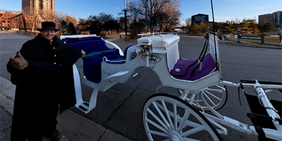 360 degree panorama of The Hitching Company’s horse and carriage on Nicollet Island on the Mississipi River in Minneapolis, Minnesota. The Hitching Company offers carriage ride tours along the Mississippi River and Nicollet Mall in downtown Minneapolis.
Equipment: NikonD70, Sigma 8mm, Kaidan QuickPan III
Categories: Minneapolis
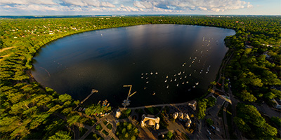
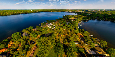
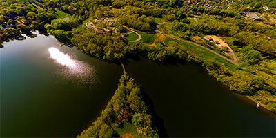
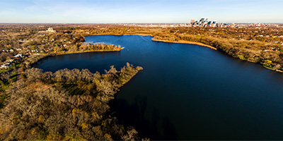 Aerial panorama over Cedar Lake in Minneapolis, MN
Equipment: DJI P3A, 20 mm
Categories: Minneapolis
 360 degree panorama with costumed characters roaming the children’s section of the Minneapolis Library during the grand opening.
Equipment: Nikon D70s, Sigma 8mm, Kaidan QuickPan III
Categories: Minneapolis Library, Minneapolis
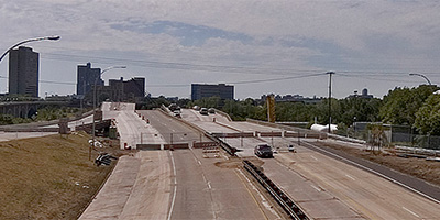
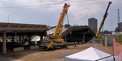 360 degree aerial panorama on 2nd St. near the collapsed I-35W.bridge spanning the Mississippi River in Minneapolis, MN.
My 8mm fisheye lens leaves me at a real disadvantage from this far back.
Equipment: NikonD70, Sigma 8mm, Nodal Ninja 3, PocketWizard Plus
Categories: 35W Bridge Collapse, Bridges, Minneapolis, Mississippi River
 360 degree panorama showing the collapsed I-35W bridge from the University of Minnesota’s bikeway bridge over the Mississippi River.
This was shot August 15th, the morning Mayor Rybak ordered the bikeway reopened, but by the afternoon Sheriff Stanek ordered the bikeway closed again.
Equipment: NikonD70, Sigma 8mm, Nodal Ninja 3, PocketWizard Plus
Categories: 35W Bridge Collapse, Bridges, Minneapolis, Mississippi River, University of Minnesota
 360 degree panorama from the University Ave. overpass near the collapsed I-35W.bridge.
Equipment: NikonD70, Sigma 8mm, Nodal Ninja 3, PocketWizard Plus
Categories: 35W Bridge Collapse, Bridges, Minneapolis, Mississippi River
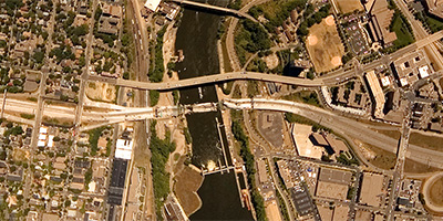 360 degree aerial panorama over the collapsed I-35W bridge spanning the Mississippi River in Minneapolis, MN.
This was shot the morning after the collapse when there was a TFR (temporary flight restriction) over the bridge, and I had to fly significantly higher than I normally shoot, so you won’t be able to see much detail in the bridge. I may be able to do more at a decent altitude when the TFR is lifted.
Equipment: Nikon D70s, Sigma 8mm, PocketWizard Plus
Helicopter: Davis Aviation
Pilot: Joanne Boyer
Categories: 35W Bridge Collapse, Bridges, Minneapolis, Mississippi River
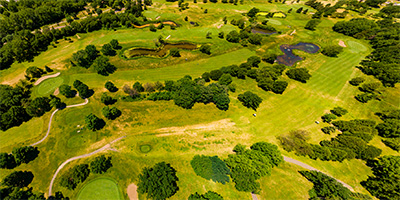 360 degree aerial panorama above Columbia Park and Columbia Golf Club in, Columbia Heights, MN.
Equipment: DJI P4P, 24 mm
Categories: Minneapolis, Quadcopter
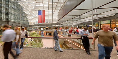 This was my submission for the 2010 Fall Equinox World Wide Panorama event Crossroads.
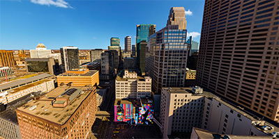
Minneapolis has the coldest average temperature of any major metropolitan area in the U.S. Due to the extreme weather the city has developed a system of enclosed, climate controlled pedestrian bridges linking the downtown buildings. The 69 block, 7 mile system is the largest continuous skyway system in the world. Located at Crystal Court under the IDS building, the skyway intersection pictured here is a major pedestrian crossroads.
Equipment: Nikon D70s, Sigma 8mm, Nodal Ninja 3, PocketWizard Plus
Categories: Minneapolis, World Wide Panorama
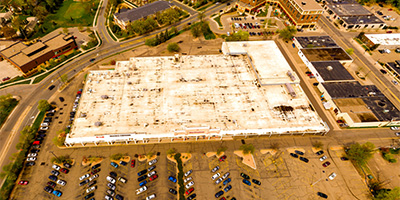
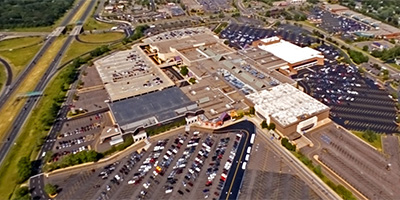
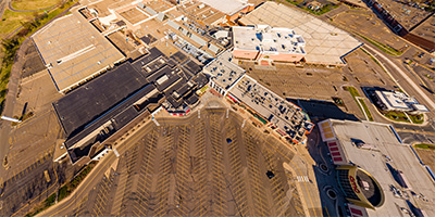 360 degree aerial panorama above a deserted Rosedale Mall during the Covid19 lockdown in Roseville, MN. My submission to the Summer Solstice World Wide Panorama on the theme Confinment.
Equipment: DJI P4P, 24 mm
Categories: Minneapolis, Quadcopter, World Wide Panorama
 Earle Brown Heritage Center 360 degree aerial panorama, Brooklyn Center, MN.
Equipment: DJI P4P, 24 mm
Categories: Minneapolis, Quadcopter
 360 degree panorama between Central Lutheran Church and the east side of the Minneapolis Convention Center. Downtown Minneapolis is visible down the street.
Equipment: NikonD70s, Sigma 8mm, Nodal Ninja 3, PocketWizard Plus
Categories: Minneapolis
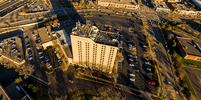
 Aerial panorama above Fairview Ridges Hospital.
Equipment: DJI P3A, 20 mm
Categories: Minneapolis, Quadcopter
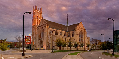
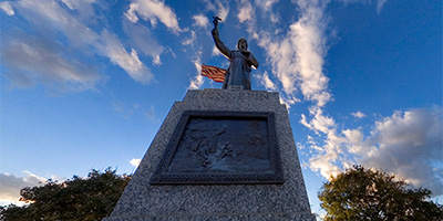 360 degree panorama at the Father Louis Hennepin statue on Hennepin Ave. in front of Saint Mary’s Basilica in Minneapolis, Minnesota.
Equipment: NikonD70s, Sigma 8mm, Nodal Ninja 3, PocketWizard Plus
Categories: Minneapolis
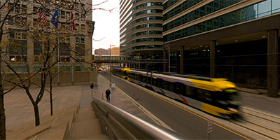 360 degree panorama along the light rail in downtown Minneapolis, with the Wells Fargo and IDS buildings disappearing into the fog above.
Equipment: NikonD70, Sigma 8mm, Kaidan QuickPan III
Categories: Minneapolis
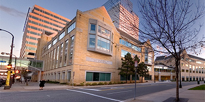
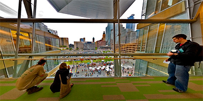 360 degree panorama of the view of the Minneapolis skyline from the fourth floor bridge of the new Minneapolis Public Library on opening day.
Equipment: Nikon D70s, Sigma 8mm, Kaidan QuickPan III
Categories: Minneapolis Library, Minneapolis
 360 degree panorama in front of Saint Mary’s Basilica on Hennepin Ave. in Minneapolis, Minnesota.
Equipment: NikonD70s, Sigma 8mm, Nodal Ninja 3, PocketWizard Plus
Categories: Minneapolis
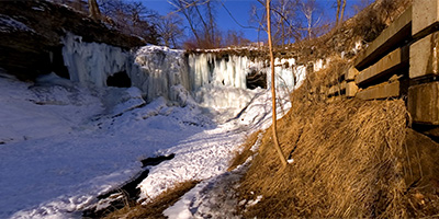 360 degree panorama of an icy Minnehaha Falls.
Equipment: NikonD70, Sigma 8mm, Kaidan QuickPan III
Categories: Featured, Minneapolis, Minnehaha Falls
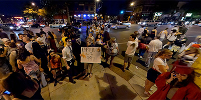
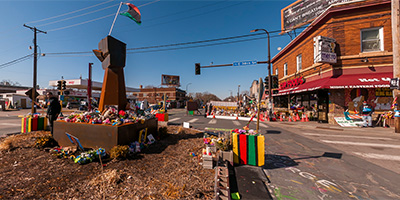 360 degree panorama at George Floyd Square at Chicago Ave. and 38th St. in Minneapolis, Minnesota. People rose up in protest worldwide after George Floyd, an unarmed black man, was killed by white police officer Derek Chauvin in front of Cup Foods on May 25, 2020. Mourners left memorials to George here, including the raised fist sculpture created during the ongoing occupation of the intersection. This was shot on the second day of Derek Chauvins trial while the crowd was downtown protesting at the courthouse.
Equipment: Nikon D300s, Sigma 8mm, Nodal Ninja Ultimate R1
Categories: Minneapolis, World Wide Panorama
 360 degree panorama next to the glass fireplace during the grand opening of the Minneapolis Public Library. Although bound to be more popular on a sub-zero day in winter, the glass fireplace attracts readers year round.
Equipment: Nikon D70s, Sigma 8mm, Kaidan QuickPan III
Categories: Minneapolis Library, Minneapolis
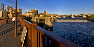
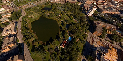
 360 degree aerial panorama directly over Gold Medal Park overlooking the Mississippi River in downtown Minnespolis, MN. The river has been drawn down to record levels to inspect the locks, exposing the river bottom in places, the exposed foot of St. Anthony Falls, and remains of older river structures.
Equipment: DJI P4P, 24 mm
Categories: 35W Bridge Collapse, Minneapolis, Mississippi River, Quadcopter, World Wide Panorama
 360 degree aerial panorama above Hansen Park in New Brighton, MN,
Equipment: DJI P4P, 24 mm
Categories: Minneapolis, Quadcopter
 360 degree aerial panorama above Hennepin County Government Center in downtown Minnepolis, MN.
Equipment: DJI P3A, 20 mm
Categories: Minneapolis, Quadcopter
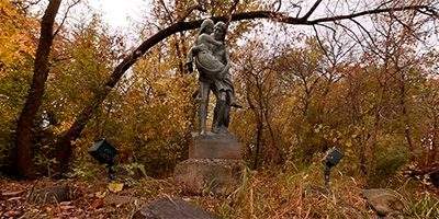 360 degree panorama in front of the Hiawatha and Minnehaha Statue at Minnehaha Falls.
Equipment: Nikon D70, Sigma 8mm
Categories: Minneapolis, Minnehaha Falls
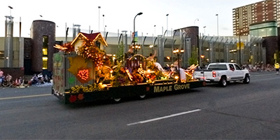
 360 degree panorama during the 2012 Holidazzle Parade at Nicollet Ave. and 9th St. in downtown Minneapolis. It is difficult getting a good picture during the parade. They turn all the street lights off, so it’s really dark and hard to get a good crowd shot, plus the floats never stop. I’m starting to think the only way I can get a good shot of a float is to put a doll in a stroller, roll it out in the middle of the street, and scream "My baby! MY BABY!!"
Equipment: Nikon D700, Nikkor 10.5mm (shaved), Nodal Ninja Ultimate R1
Categories: Holidazzle Parade, Minneapolis, World Wide Panorama
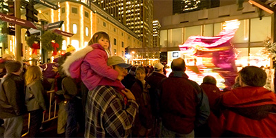 360 degree panorama during the Holidazzle Parade at Nicollet and 7th in downtown Minneapolis, with Mary Tyler Moore looking on.
Equipment: NikonD70, Sigma 8mm, Kaidan QuickPan III
Categories: Holidazzle Parade, Minneapolis
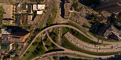 360 degree aerial panorama over the I-94 Lowry Tunnel in Minneapolis. Visible landmarks from here include the Walker Art Center and Sculpture Garden, Hennepin Ave., Lyndale Ave, and Loring Park, and downtown Minneapolis.
Equipment: Nikon D70s, Sigma 8mm, PocketWizard Plus
Helicopter: Davis Aviation
Pilot: Mark Boyer
Categories: Minneapolis
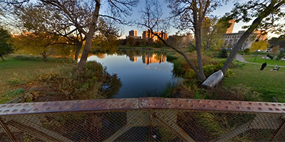 360 degree panorama at sunset on the bridge over Johnson’s Lake in Loring Park in downtown Minneapolis, Minnesota.
Equipment: NikonD70s, Sigma 8mm, Nodal Ninja 3, PocketWizard Plus
Categories: Minneapolis
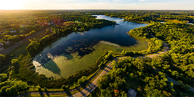
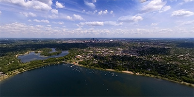 360 degree aerial panorama over Lake Calhoun, one of the more popular lakes in the Minneapolis chain of lakes.
Equipment: NikonD70, Sigma 8mm
Helicopter: Hummingbird Helicopters
Pilot: John Lindstrom
Categories: Minneapolis
 360 degree aerial panorama over the Lake Harriet Bandshell in Minneapolis, MN.
Equipment: DJI P4P, 24 mm
Categories: Minneapolis, Quadcopter
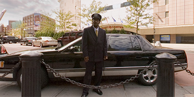 360 degree panorama with Lincoln Town Car across from Target Center in downtown Minneapolis, MN.
Equipment: Nikon D70, Sigma 8mm
Categories: Minneapolis, Vehicles
 360 degree panorama at sunset in Loring Park in downtown Minneapolis, Minnesota.
Equipment: NikonD70s, Sigma 8mm, Nodal Ninja 3, PocketWizard Plus
Categories: Minneapolis
 360 degree aerial panorama over Loring Park in downtown Minneapolis. Visible landmarks from here include the Walker Art Center and Sculpture Garden, the Basilica of Saint Mary, the Minneapolis Convention Center, downtown Minneapolis.
Equipment: Nikon D70s, Sigma 8mm, PocketWizard Plus
Helicopter: Davis Aviation
Pilot: Mark Boyer
Categories: Minneapolis
 Over the Mississippi River near the Lowry Avenue Bridge in Minneapolis, Minnesota
Equipment: DJI P4P, 24 mm
Categories: Bridges, Minneapolis, Mississippi River, Quadcopter
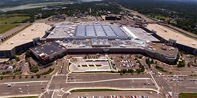 360 degree aerial panorama of the Mall of America, the largest mall in the U.S.
Equipment: NikonD70, Sigma 8mm
Helicopter: Hummingbird Helicopters
Pilot: John Lindstrom
Categories: Mall of America, Minneapolis
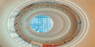 Mall of America Atrium
Equipment: Nikon D700, Nikkor 10.5mm (shaved), Nodal Ninja Ultimate R1
Categories: Mall of America, Minneapolis, World Wide Panorama
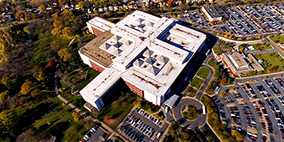
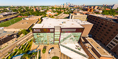 University of Minnesota Masonic Childrens Hospital.
Equipment: DJI P3A, 20 mm
Categories: Minneapolis, Quadcopter
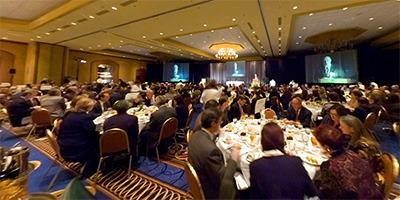
 360 degree panorama of Mayor Rybak speaking at the Minneapolis Downtown Council 2005 Annual Meeting.
Equipment: NikonD70, Sigma 8mm, Kaidan QuickPan III
Categories: Government, Minn. Downtown Council, Minneapolis
 Micro Center Computers in St. Louis Park
Equipment: DJI P4P, 24 mm
Categories: Minneapolis, Quadcopter
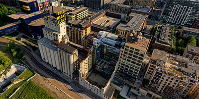
 360 degree aerial panorama at the Mill City Museum. My submission to World Wide Panorama: Museums.
The Mill City Museum is built in the ruins of what was once the worlds largest flour mill. The museum focuses on the founding and growth of Minneapolis, especially flour milling and the other industries that used hydropower from the nearby Saint Anthony Falls on the Mississippi River.
The first Washburn A Mill was the largest flour mill in the world and contributed to the development of Minneapolis. On May 2, 1878, a spark ignited airborne flour dust creating an explosion that demolished the Washburn A and killed 18 workers instantly. The ensuing fire resulted in the deaths of four more people and destroyed five other mills.
Known as the Great Mill Disaster, the explosion served as a focal point for reforms in the milling industry to prevent the buildup of combustible flour dust.
360 degree aerial panorama at the Mill City Museum. My submission to World Wide Panorama: Museums.
The Mill City Museum is built in the ruins of what was once the worlds largest flour mill. The museum focuses on the founding and growth of Minneapolis, especially flour milling and the other industries that used hydropower from the nearby Saint Anthony Falls on the Mississippi River.
The first Washburn A Mill was the largest flour mill in the world and contributed to the development of Minneapolis. On May 2, 1878, a spark ignited airborne flour dust creating an explosion that demolished the Washburn A and killed 18 workers instantly. The ensuing fire resulted in the deaths of four more people and destroyed five other mills.
Known as the Great Mill Disaster, the explosion served as a focal point for reforms in the milling industry to prevent the buildup of combustible flour dust.
Equipment: DJI Air2s, 22 mm
Categories: Minneapolis, Mississippi River, World Wide Panorama
 360 degree aerial panorama at the Mill City Museum. An alternate shot for my submission to World Wide Panorama: Museums, about 100' higher than the shot I used.
The Mill City Museum is built in the ruins of what was once the worlds largest flour mill. The museum focuses on the founding and growth of Minneapolis, especially flour milling and the other industries that used hydropower from the nearby Saint Anthony Falls on the Mississippi River.
The first Washburn A Mill was the largest flour mill in the world and contributed to the development of Minneapolis. On May 2, 1878, a spark ignited airborne flour dust creating an explosion that demolished the Washburn A and killed 18 workers instantly. The ensuing fire resulted in the deaths of four more people and destroyed five other mills.
Known as the Great Mill Disaster, the explosion served as a focal point for reforms in the milling industry to prevent the buildup of combustible flour dust.
360 degree aerial panorama at the Mill City Museum. An alternate shot for my submission to World Wide Panorama: Museums, about 100' higher than the shot I used.
The Mill City Museum is built in the ruins of what was once the worlds largest flour mill. The museum focuses on the founding and growth of Minneapolis, especially flour milling and the other industries that used hydropower from the nearby Saint Anthony Falls on the Mississippi River.
The first Washburn A Mill was the largest flour mill in the world and contributed to the development of Minneapolis. On May 2, 1878, a spark ignited airborne flour dust creating an explosion that demolished the Washburn A and killed 18 workers instantly. The ensuing fire resulted in the deaths of four more people and destroyed five other mills.
Known as the Great Mill Disaster, the explosion served as a focal point for reforms in the milling industry to prevent the buildup of combustible flour dust.
Equipment: DJI Air2s, 22 mm
Categories: Minneapolis, Mississippi River, World Wide Panorama
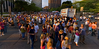
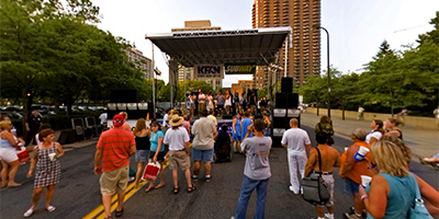 360 degree panorama in downtown Minneapolis on Marquette Ave. at the KFAN stage during the 2005 Aquatennial block party.
Equipment: NikonD70, Sigma 8mm, Kaidan QuickPan III
Categories: Aquatennial, Minneapolis
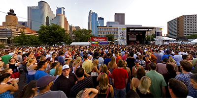 360 degree panorama at the Cities 97 Main Stage between Hennepin Ave. and Nicollet Ave. during the 2005 Minneapolis Aquatennial block party.
Equipment: NikonD70, Sigma 8mm, Kaidan QuickPan III
Categories: Aquatennial, Minneapolis
 360 degree panorama of the Aquatennial block party in downtown Minneapolis at Washington Ave. and Marquette Ave.
Equipment: NikonD70, Sigma 8mm, Kaidan QuickPan III
Categories: Aquatennial, Minneapolis
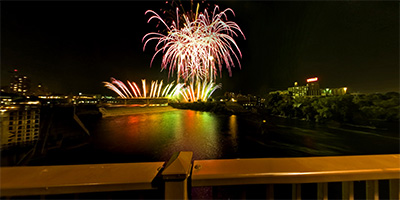 360 degree panorama of Minneapolis Aquatennial Fireworks shot from the Stone Arch Bridge, with St. Anthony Falls, the only waterfall on the entire length of the Mississippi River, illuminated by fireworks.
Equipment: NikonD70, Sigma 8mm, Kaidan QuickPan III
Categories: Aquatennial, Minneapolis
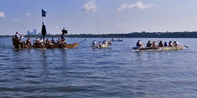 360 degree panorama of the Minneapolis Aquatennial Milk Carton Boat Race on Lake Calhoun.
Equipment: NikonD70, Sigma 8mm, Kaidan QuickPan III
Categories: Aquatennial, Minneapolis
 360 degree panorama of contestants working on their entry in the Minneapolis Aquatennial Sandcastle competition on Lake Calhoun.
Equipment: NikonD70, Sigma 8mm, Kaidan QuickPan III
Categories: Aquatennial, Minneapolis
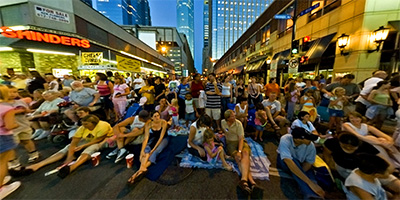 360 degree panorama of the Minneapolis Aquatennial Torchlight Parade at 8th St. and Hennepin Ave. in downtown Minneapolis.
Equipment: NikonD70, Sigma 8mm, Kaidan QuickPan III
Categories: Aquatennial, Minneapolis
 360 degree panorama of the Minneapolis Aquatennial Torchlight Parade on Hennepin Ave. in downtown Minneapolis.
Equipment: NikonD70, Sigma 8mm, Kaidan QuickPan III
Categories: Aquatennial, Minneapolis
 360 degree panorama from the Minneapolis Convention Center Plaza. Also has a nice view of downtown Minneapolis at sunset.
Equipment: NikonD70s, Sigma 8mm, Nodal Ninja 3, PocketWizard Plus
Categories: Minneapolis
 360 degree panorama at the Minneapolis Downtown Council 2005 Annual Meeting.
Equipment: NikonD70, Sigma 8mm, Kaidan QuickPan III
Categories: Minn. Downtown Council, Minneapolis
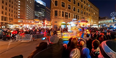
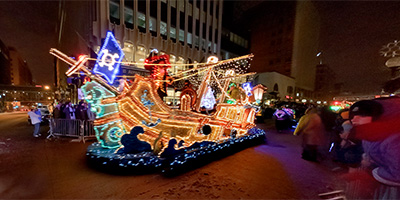 360 degree panorama during the 2010 Holidazzle Parade at Nicollet Ave. and 8th St. in downtown Minneapolis. The crowd is usually as interesting as the floats, so I really wish they’d keave the street lights on for at least one parade. Better yet, for just one night leave all the downtown building lights on too, get a sponsor like Nikon and call it the "Nikon Light Up The Night Holidazzle Parade." I bet it would be the most popular night for Holidazzle!
Equipment: Nikon D700, Nikkor 10.5mm (shaved), Nodal Ninja 3
Categories: Holidazzle Parade, Minneapolis
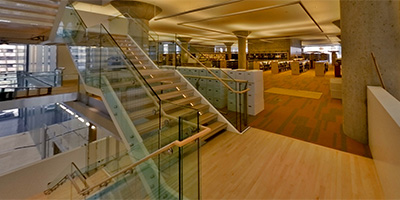 360 degree panorama inside the new Minneapolis Library two months before opening.
Equipment: NikonD70, Sigma 8mm, Kaidan QuickPan III
Categories: Minneapolis Library, Minneapolis
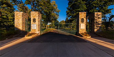 360 degree panorama at the gates to the Minneapolis Pioneer and Soldiers Memorial Cemetery. Established in 1853, it is the oldest cemetery in Minneapolis. About 2,000 people are buried here, including early African-American residents, 200 veterans, and several thousand immigrants, along with infamous Harry Hayward, the first documented American serial killer. This was my submission for the World Wide Panorama Fall Equinox 2013 event Mortality. I wanted to go inside the cemetery, but procrastinator that I am, I arrived too late, on the last day of shooting, and couldn’t get in. I decided to shoot anyway - a padlocked gate at an endangered historical cemetery still seems like a good fit for Mortality, plus it makes me think about all the people who have warned me that I will be late for my own funeral.
Equipment: Nikon D700, Nikkor 10.5mm (shaved), Nodal Ninja Ultimate R1
Categories: Minneapolis, World Wide Panorama
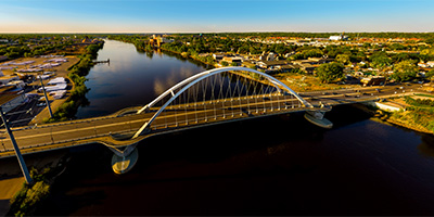
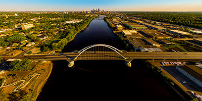
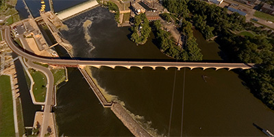
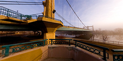 360 degree panorama of the Father Louis Hennepin Bridge as it disappears into the morning fog over the Mississippi River in downtown Minneapolis during the first week of spring. The bridge is in First Bridge Park, and was built at the site of the first bridge in the country to span the Mississippi River.
The only building visible in the fog is the Minneapolis Post Office, which is on the site of the first permanent white dwelling on the west bank of the river.
This was an alternate shot for the 2007 Spring Equinox World Wide Panorama "Atmosphere" event.
Equipment: Nikon D70s, Sigma 8mm, Kaidan QuickPan III
Categories: Bridges, Minneapolis, Mississippi River, World Wide Panorama
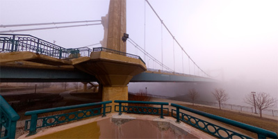 360 degree panorama of the Father Louis Hennepin Bridge disappearing into the morning fog over the Mississippi River in downtown Minneapolis during the first week of spring. The bridge is in First Bridge Park, and was built at the site of the first bridge in the country to span the Mississippi River.
The only building visible in the fog is the Minneapolis Post Office, which is on the site of the first permanent white dwelling on the west bank of the river.
This was my submission for the 2007 Spring Equinox World Wide Panorama "Atmosphere" event.
Equipment: Nikon D70s, Sigma 8mm, Kaidan QuickPan III
Categories: Bridges, Minneapolis, Mississippi River, World Wide Panorama
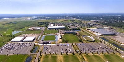 360 degree aerial panorama over National Sports Center in Blaine, MN, near Anoka County Airport
Equipment: NikonD70, Sigma 8mm
Helicopter: Whirlwind Helicopters
Pilot: Ray
Categories: Minneapolis
 360 degree panorama at night from the I-35W Mississippi River Bridge in Minneapolis, Minnesota. This was shot the first weekend after the bridge was complete. When I started setting up, the river boat had just entered the Lower Saint Anthony Lock from downstream, and by the time I was finished shooting the lock had filled and the boat was leaving.
Don’t try shooting here yourself! A lady cop showed up just as I finished and she wrote me a ticket and gave me an angry 20 minute pedestrian safety lecture. You don’t want to run into her - she’s kind of "excitable". Any other cop would have ignored me, or calmly said "You’re not allowed to walk on the bridge, move on please." No - this cop doesn’t know the meaning of calm. She was almost hysterical, SCREAMING: "WHAT THE HELL DO YOU THINK YOU’RE DOING??!! WHO THE HELL DO YOU THINK YOU ARE???!! YOU’RE CRAZY!!!! YOU’RE OUT OF YOUR MIND!!!! WHAT AN IDIOT!!!! NOW I HAVE TO WASTE MY TIME WRITING YOU A CITATION!!"
I’ve got a bad knee, and as I was struggling to get out of her back seat with all my equipment, she started screaming again: "HURRY UP SIR! COME ON NOW!!! I DON"T HAVE ALL NIGHT!! GET!!! OUT!!!!"
I was hoping she’d just yell and not give me a ticket (no such luck!), so I was super polite to her. If that’s the way she treats a quiet, polite, professional photographer over twice her age, she must be hell on REAL criminals, like jaywalkers and litterbugs!!
Maybe she thought if she screamed enough she could "get through to me" and one day I would thank her for making me a better pedestrian? Yawn
not likely. I’ve done things FAR stupider than walking on a bridge. :)
Equipment: Nikon D70s, Sigma 8mm, Nodal Ninja 3, PocketWizard Plus
Categories: 35W Bridge Collapse, Bridges, Minneapolis, Mississippi River
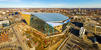 360 degree aerial panorama of the 90% complete Vikings Stadium in downtown Minneapolis, MN.
Equipment: DJI P3A, 20 mm
Categories: Minneapolis, Quadcopter
 360 degree aerial panorama at Normandale Lake / Hyland Hills Ski Area in Bloomington, MN,
Equipment: DJI P4P, 24 mm
Categories: Minneapolis, Quadcopter
 North of the Lowry Avenue Bridge over the Mississippi River in Minneapolis, Minnesota
Equipment: DJI P4P, 24 mm
Categories: Bridges, Minneapolis, Mississippi River, Quadcopter
 360 degree panorama along the Paisley Park fence during the Prince memorial.
Equipment: Nikon D700, Nikkor 10.5mm (shaved), Nodal Ninja Ultimate R1
Categories: Minneapolis, Music, Prince Memorials
 Aerial panorama over DoubleTree Park Place near I-394 and Hwy 100 in St. Louis Park, MN
Equipment: DJI P3A, 20 mm
Categories: Minneapolis, Quadcopter
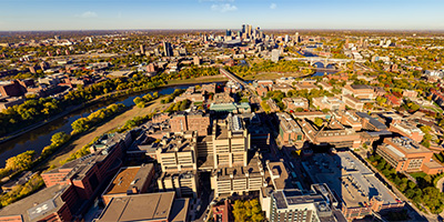 360 degree aerial panorama over the University of Minnesota at the Phillips-Wangensteen Building in Minneapolis, MN.
Equipment: DJI P4P, 24 mm
Categories: Minneapolis, Quadcopter, University of Minnesota
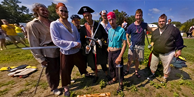 360 degree panorama of pirates with their entry in the Minneapolis Aquatennial Milk Carton Boat Race on Lake Calhoun.
Equipment: NikonD70, Sigma 8mm, Kaidan QuickPan III
Categories: Aquatennial, Minneapolis
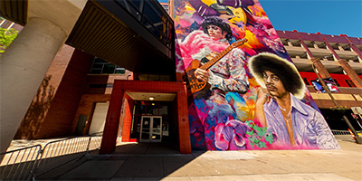 360 degree panorama in front of the just completed Prince mural in Minneapolis, MN.
Equipment: Ricoh Theta Z1, FE
Categories: Minneapolis, Music, Prince Memorials
360 degree panorama in front of the just completed Prince mural in Minneapolis, MN.
Equipment: Ricoh Theta Z1, FE
Categories: Minneapolis, Music, Prince Memorials
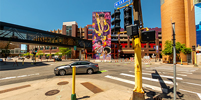 360 degree panorama in front of the just completed Prince mural from First Avenue, Minneapolis, MN.
Equipment: Ricoh Theta Z1, FE
Categories: Minneapolis, Music, Prince Memorials
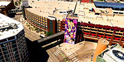 360 degree aerial panorama above First Avenue showing the Prince Mural.
Equipment: DJI P4P, 24 mm
Categories: Minneapolis, Music, Prince Memorials, Quadcopter
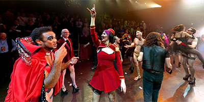
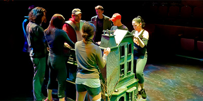
 360 degree panorama during Andrew Rasmussen’s production of Rocky Horror Live in Minneapolis at the LAB Theatre.
Equipment: Nikon D700, Nikkor 10.5mm (shaved), Nodal Ninja Ultimate R1
Categories: Minneapolis, Music, Rocky Horror Live!
 360 degree panorama during the final performance of Andrew Rasmussen’s production of Rocky Horror Live on Halloween night at the LAB Theatre in Minneapolis.
Equipment: Nikon D700, Nikkor 10.5mm (shaved), Nodal Ninja Ultimate R1
Categories: Minneapolis, Music, Rocky Horror Live!
 360 degree panorama from the stage floor during the final performance of Andrew Rasmussen’s production of Rocky Horror Live on Halloween night at the LAB Theatre in Minneapolis.
Equipment: Nikon D700, Nikkor 10.5mm (shaved), Nodal Ninja Ultimate R1
Categories: Featured, Minneapolis, Music, Rocky Horror Live!
 360 degree panorama during a rehearsal of Andrew Rasmussen’s production of Rocky Horror Live at the LAB Theatre in Minneapolis.
Equipment: Nikon D700, Nikkor 10.5mm (shaved), Nodal Ninja Ultimate R1
Categories: Minneapolis, Music, Rocky Horror Live!
 360 degree aerial panorama over Hwy. 36 at Snelling Ave in Roseville, MN. Visible landmarks include Rosedale Mall, Har Mar Mall, and Cedarholm Golf Course.
Equipment: NikonD70, Sigma 8mm
Helicopter: Whirlwind Helicopters
Pilot: Ray
Categories: Minneapolis
 360 degree panorama beside Saint Mary’s Basilica in Minneapolis, Minnesota.
Equipment: NikonD70s, Sigma 8mm, Nodal Ninja 3, PocketWizard Plus
Categories: Minneapolis
 Silverwood Park at Silver Lake, in St. Anthony, MN
Equipment: DJI P4P, 24 mm
Categories: Minneapolis, Quadcopter
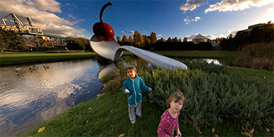 360 degree panorama next to the Spoonbridge and Cherry sculpture by Claes Oldenburg and Coosje van Bruggen, the centerpiece of the Walker Arts Center/Minneapolis Sculpture Garden.The giant sculpture with it’s 5,800 pound aluminum spoon and 1,200 pound cherry is one of Minneapolis’ most famous landmarks.
Equipment: NikonD70s, Sigma 8mm, Nodal Ninja 3, PocketWizard Plus
Categories: Featured, Minneapolis
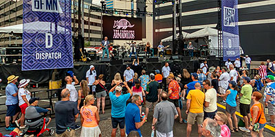 360 degree panorama of The Fabulous Armadillos playing in downtown Minneapolis at the 2023 Taste Of Minnesota.
Equipment: Ricoh Theta Z1, FE
Categories: Minneapolis
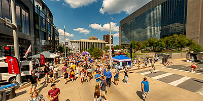 360 degree panorama on Nicollet Mall at 3rd St. in downtown Minneapolis at the 2023 Taste Of Minnesota.
Equipment: Ricoh Theta Z1, FE
Categories: Minneapolis
 360 degree panorama on Nicollet Mall at 4th St. in downtown Minneapolis at the 2023 Taste Of Minnesota.
Equipment: Ricoh Theta Z1, FE
Categories: Minneapolis
 360 degree panorama on Nicollet Mall in downtown Minneapolis at the THC beverages booth during the 2023 Taste Of Minnesota.
Equipment: Ricoh Theta Z1, FE
Categories: Minneapolis
 360 degree aerial panorama over the Minneapolis Central Library on Nicollet Mall in downtown Minneapolis during the 2023 Taste Of Minnesota.
Equipment: DJI Air2s, 22 mm
Categories: Minneapolis, Quadcopter
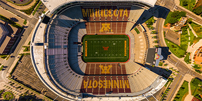 TCF Stadium at the University of Minnesota
Equipment: DJI P3A, 20 mm
Categories: Minneapolis, Quadcopter, University of Minnesota
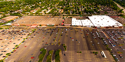 360 degree aerial panorama of the Quarry shopping center in Minneapolis, MN.
Equipment: DJI P3A, 20 mm
Categories: Minneapolis, Quadcopter
 400' above Theodore Wirth Regional Park in Golden Valley, just west of Minneapolis, Minnesota.
Equipment: DJI P4P, 24 mm
Categories: Minneapolis, Quadcopter
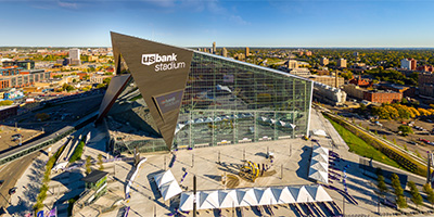 360 degree aerial panorama of the Viking’s U.S. Bank stadium, and location of Super Bowl 52 in downtown Minneapolis, MN.
Equipment: DJI P3A, 20 mm
Categories: Minneapolis, Quadcopter
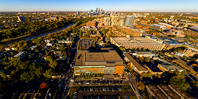 Aerial panorama over the University of Minnesota Health Clinics and Surgery Center in Minneapolis, MN.
Equipment: DJI P3A, 20 mm
Categories: Minneapolis, Quadcopter, University of Minnesota
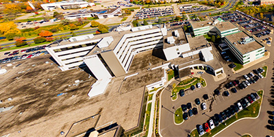
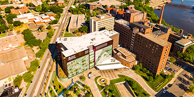 University of Minnesota Medical Center.
Equipment: DJI P3A, 20 mm
Categories: Minneapolis, Quadcopter
 360 degree aerial panorama over the VA Medical Center in Minneapolis, MN. Visible landmarks include the Mississippi River, Minneapolis/St. Paul Airport, and Fort Snelling.
Equipment: NikonD70, Sigma 8mm
Helicopter: Davis Aviation
Pilot: Joanne Boyer
Categories: Minneapolis, Veterans
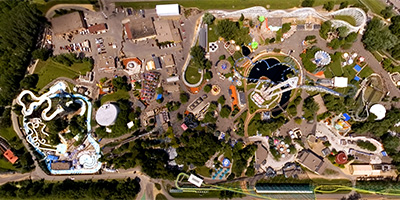 360 degree aerial panorama over Valleyfair amusement park in Shakopee, MN. Visible landmarks include Minnesota River and Canterbury Downs.
Equipment: NikonD70, Sigma 8mm
Helicopter: Hummingbird Helicopters
Pilot: John Lindstrom
Categories: Minneapolis, Minnesota River
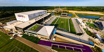 360 degree aerial panorama at the Minnesota Vikings Training Facility, Edina, MN.
Equipment: DJI P4P, 24 mm
Categories: Minneapolis, Quadcopter
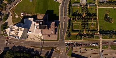
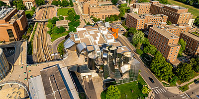 360 degree aerial panorama at Weisman Art Museum on the University of Minnesota Campus along the Mississippi River in Minneapolis, MN. This was planned for World Wide Panorama: Museums but I submitted a Mill City Museum aerial instead.
Equipment: DJI Air2s, 22 mm
Categories: Minneapolis, Mississippi River, University of Minnesota
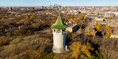 Witch’s Hat Water Tower in Tower Hill Park, Minneapolis, MN. This decommissioned water tower was the inspiration for Bob Dylan’s All Along The Watchtower. Built on the highest hill in Minneapolis, the tower is clearly visible from Bob Dylan’s former Dinkytown neighborhood.
Equipment: DJI P3A, 20 mm
Categories: Minneapolis, Quadcopter
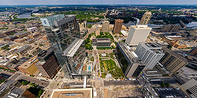
 360 degree aerial panorama of the North Loop in Minneapolis, MN.
Equipment: DJI Air2s, 22 mm
Categories: Minneapolis, Quadcopter
 360 degree panorama of zombies walking around the West Bank at the 7th annual Twin Cities Zombie Pub Crawl.
Equipment: Nikon D700, Nikkor 10.5mm (shaved), Nodal Ninja Ultimate R1
Categories: Minneapolis, Zombies
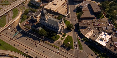 360 degree aerial panorama near the Basilica of Saint Mary, a hundred year old church in downtown Minneapolis, Minnesota.
Equipment: Nikon D70s, Sigma 8mm, PocketWizard Plus
Helicopter: Davis Aviation
Pilot: Mark Boyer
Categories: Minneapolis
 360 degree aerial panorama over Target Center and the Block E entertainment district in downtown Minneapolis. Visible landmarks include the First Ave. nightclub, Hard Rock Cafe, end of the light rail line, and construction at the site of the new Twins Stadium.
Equipment: Nikon D70s, Sigma 8mm, PocketWizard Plus
Helicopter: Davis Aviation
Pilot: Mark Boyer
Categories: Minneapolis
 360 degree aerial panorama over the Mississippi River near Boom Island and Nicollet Island . Visible landmarks from here include Nicollet Island, St. Anthony Falls, and downtown Minneapolis.
Equipment: Nikon D70s, Sigma 8mm, PocketWizard Plus
Helicopter: Davis Aviation
Pilot: Mark Boyer
Categories: Minneapolis, Mississippi River
 360 degree aerial panorama over the Central/Third Ave. Bridge across the Mississippi River in downtown Minneapolis. Visible landmarks from here include Nicollet Island, St. Anthony Falls, and the Metrodome.
Equipment: Nikon D70s, Sigma 8mm, PocketWizard Plus
Helicopter: Davis Aviation
Pilot: Mark Boyer
Categories: Bridges, Minneapolis, Mississippi River
 360 degree aerial panorama over the Father Louis Hennepin Bridge, aka First Bridge, built on the site of the first bridge anywhere on the entire length of the Mississippi River. Visible landmarks from here include Nicollet Island, St. Anthony Falls, and downtown Minneapolis.
Equipment: Nikon D70s, Sigma 8mm, PocketWizard Plus
Helicopter: Davis Aviation
Pilot: Mark Boyer
Categories: Bridges, Minneapolis, Mississippi River
 360 degree aerial panorama over the Minneapolis Convention Center in downtown Minneapolis. Visible landmarks from here are the Hyatt Regency, the Millennium Hotel, Doubletree Hotel, Minneapolis Hilton, Target Center, and the Metrodome.
Equipment: Nikon D70s, Sigma 8mm, PocketWizard Plus
Helicopter: Davis Aviation
Pilot: Mark Boyer
Categories: Minneapolis
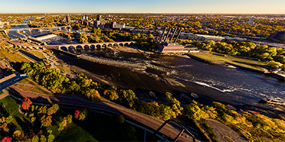
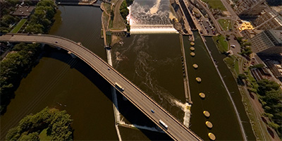
 360 degree aerial panorama in Minneapolis directly over Saint Anthony Falls, the only falls on the entire length of the Mississippi River. Visible landmarks include the Stone Arch Bridge, the Guthrie Theatre, the Metrodome, Nicollet Island, and the northernmost lock and dam on the Mississippi River.
Equipment: Nikon D70s, Sigma 8mm, PocketWizard Plus
Helicopter: Davis Aviation
Pilot: Mark Boyer
Categories: Featured, Minneapolis, Mississippi River
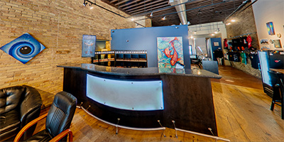 360 degree panorama inside Smokeless - Vape and CBD in NE Minneapolis, MN.
Equipment: Ricoh Theta Z1, FE
Categories: Minneapolis
 The Stone Arch Bridge near downtown Minneapolis used to be a railroad bridge. Today it a pedestrian and bicycle bridge. It is the only arched bridge made of stone on the entire length of the Mississippi River.
Equipment: Nikon D70s, Sigma 8mm, PocketWizard Plus
Helicopter: Davis Aviation
Pilot: Mark Boyer
Categories: Bridges, Minneapolis, Mississippi River
 360 degree aerial panorama over the Walker Art Center and Sculpture Garden in Minneapolis, Minnesota.
Equipment: Nikon D70s, Sigma 8mm, PocketWizard Plus
Helicopter: Davis Aviation
Pilot: Mark Boyer
Categories: Minneapolis
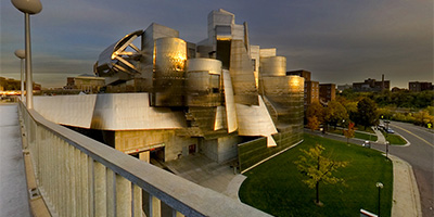 360 degree panorama of the Weisman Art Museum and Mississippi River bridge at sunset.
Equipment: Nikon D70, Sigma 8mm
Categories: Minneapolis, Mississippi River, University of Minnesota

Start with the "Featured" category to see an assortment of my most interesting panoramas.